
Via Apsyrtides
STAGE 8
OSOR - ĆUNSKI
STAGE 8
OSOR - ĆUNSKI
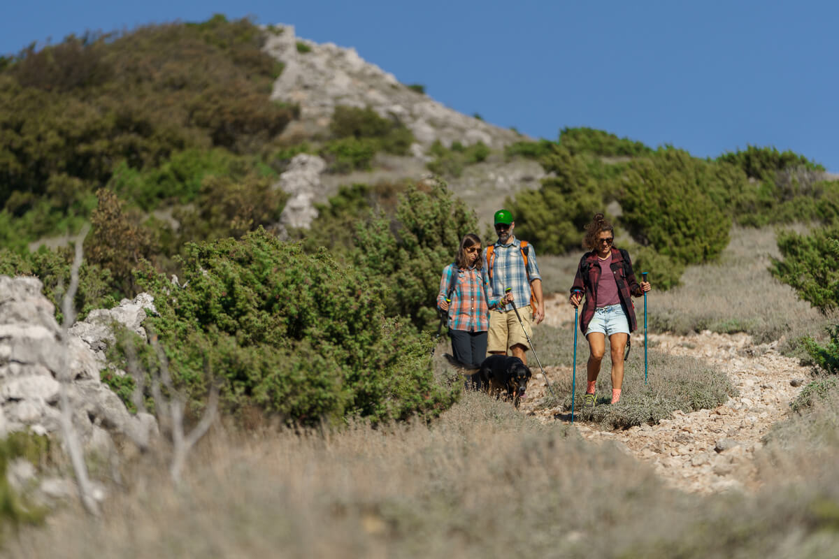
HARD
Osor has been inhabited for 3000 years. The original Liburnian hillfort was turned into a well-fortified and organised town by the Romans, to be sacked and burned down by the Saracens in 840. Once rebuilt, it regained its prosperity in the days of the Croatian-Hungarian kings, only to be sacked and burned down again by the Genoese in 1377. This would mark the beginning of the end of Osor. The Venetians tried to revive it by fortifying the more preserved half of the town, in the centre of which they built a new episcopal complex featuring a charming cathedral. Their efforts were in vain since the new navigation routes no longer passed through its channel, and the situation was made worse with the outbreak of deadly malaria in the marshy surroundings of the town. The island’s duke and bishop moved to the “healthier” town of Cres, and Osor began its slow transformation into what it is today known as – “a museum town”.
-
19 km
-
910 m
-
HIGHEST POINT: 567 m
-
LOWEST POINT : 0 m
-
DIFFICULTY: 9/10
-
DURATION: 4 h
DIFFICULTY
LANDSCAPE
ENDURANCE
EXPERIENCE
KAVUADA
Originally, Cres and Lošinj formed a particularly long island, which is why the first seafarers transported their boats over the low stretch of land near Osor instead of making the arduous journey of going around the island. Was it the Liburnians who first dug the channel here, or was it the Romans, this we can’t tell. But one thing is for sure – allowing boats to pass represented a generous source of income for Osor for centuries, for as long as the boats traveled “the old way”, more by rowing than sailing. By the 15th century, the channel had been silted up several times due to neglect, and the islands once again become one.
ST. NIKOLA
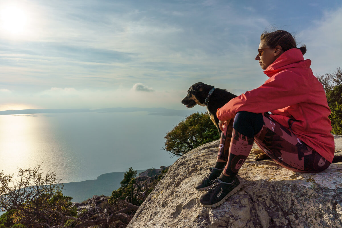
Although standing at a height of only 588 m (highest peak of Televrin), Osoršćica is in many ways a remarkable island mountain. Its caves were inhabited by humans from the Stone Age (Vela Jama site) and medieval hermits (cave of St. Gaudentius). The highest peak takes its name from their long gone hermitage of St. Nicholas (or Mikula), offering a view of the whole of Kvarner, its exquisite beauty attracting even the heir to the Austro-Hungarian throne Rudolf in 1887. Even today, the picturesque beauty and rich flora of Osoršćica fascinates all nature lovers.
POLANŽA
At the hilltop (212 m above sea level), north-west of the village of Ćunski, still stands the remains of a great ancient hillfort. The dominant position over the fertile field of Ćunski, the vicinity of a source of drinking water in Studenčić Bay at the foot of the hill, as well as numerous fragments of pottery, all bear witness to the centuries- or even millennia-old history of Polanža. Today, looking out over the vast plain in the southwest, it is difficult to imagine that this area was once covered by lush vineyards and fields of grain rippling in the wind.
SHARE THIS TRAIL
- RULES
- SERVICES
- SAFETY & EQUIPMENT
- GETTING THERE
• Via Apsyrtides trail system is intended for experienced mountain climbers and recreationists. The trails provide a basic level of walkability, without additional measures of safety and protection. Use these trails at your own risk!
• Rugged landscape and climatic conditions of the island can be challenging. Assess your fitness level well and wear appropriate footwear and clothing!
• Water availability in some villages is limited. Carry enough water with you!
• Your responsibility is to follow the laws and regulations of the Republic of Croatia related to nature protection, accommodation and respect for other people’s property.
• Leave only footprints, take only memories! Dispose of garbage in the villages, in designated areas. Do not collect wild plants and do not disturb animals you come across! Keep the gates closed behind you!
• You are in an area of high wildfire risk. Lighting open fires is strictly forbidden!
• Water: in Osor (next to the bus stop, towards the bell tower)
• Convenience store: in Osor, Nerezine and Ćunski. Working hours
• Café: in Osor, Nerezine and Ćunski
• Restaurant: in Osor, Nerezine and Ćunski
• Pharmacy: in Nerezine (Smeraldo) and Mali Lošinj (Muškardin and Kaštel Fram)
• Physician: in Mali Lošinj
• ATM: in Osor (next to the bus stop, towards the bell tower)
SAFETY INFORMATION
Mind the strong Bura wind, especially in winter and pay attention to:
- ticks
- scorpions
- wild animals (wild boar)
- heat
RECOMMENDED EQUIPMENT
- GPS
- water
- waterfilter
- mobile phone
- headlamp
The section starts at Preko mosta A/C, next to the movable bridge in Osor. The path takes you toward the Osoršćica mountain lodge. You can use the public parking lot.