
Via Apsyrtides
STAGE 2
BELI - PREDOŠĆICA
STAGE 2
BELI - PREDOŠĆICA
HARD
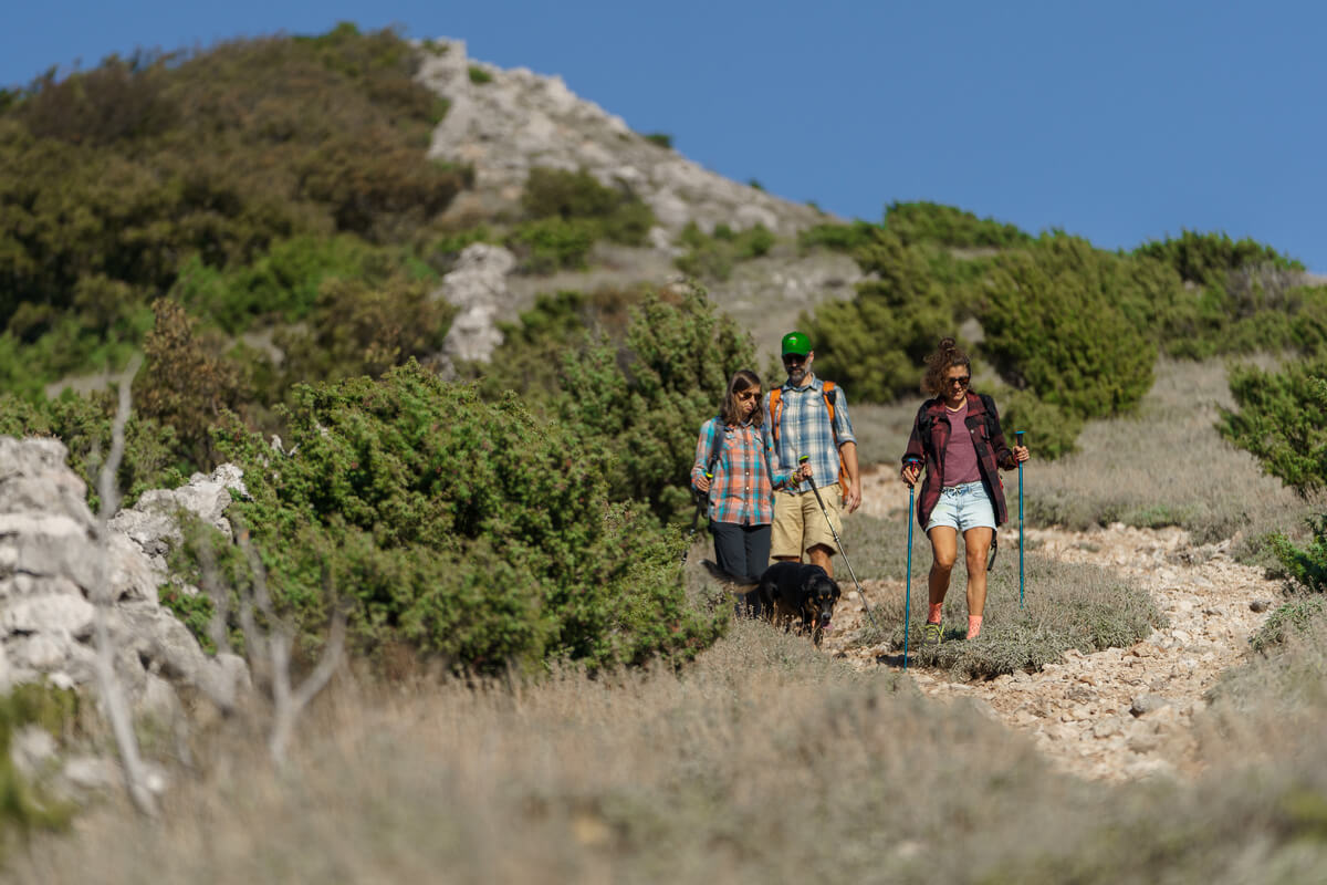
South of Beli, the island narrows and grows in height, and the forests are replaced by maquis shrubland and barren rocky terrain whipped by the wind. This is also the location of the highest peaks on Cres – Orline, Gorice and Sis, all at an altitude of more than 600 m above sea level. Circling around them are golden eagles, short-toed eagles, peregrine falcons and griffon vultures – magnificent birds with a wingspan of up to 280 cm, that are rare and endangered. They nest on cliffs above the east coast of Cres, in ornithological reserves “Kruna“ and “Pod Okladi“. They can often be seen gliding on the warm currents around Križić Pass, where Cres is only 2 km wide, and the island highway “hangs” 370 m above the sea. This is where the famous Cres rocky pastures enter the scene, a landscape driven by thousands of years of grazing by once numerous sheep.
-
10.5 km
-
700 m
-
HIGHEST POINT: 622 m
-
LOWEST POINT : 141 m
-
DIFFICULTY: 7/10
-
DURATION: 4 h

DIFFICULTY
LANDSCAPE
ENDURANCE
EXPERIENCE
SV. PETAR (St. Peter)
On the road to one of the oldest villages in Tramuntana, developed from a shepherds’ dwelling belonging to the Cres noble family Colombis, stands a downy oak already mentioned in 400-year-old records as a tree of great size. It was declared a protected natural monument in 1997, although all of its branches were sadly broken by storms in 2003 and 2021. Some comfort can still be found in its hollow trunk. You can squeeze in and, if you are lucky, you might just run into Macmalić – the mischievous forest elf hiding in the tree. There are still plenty of other ancient trees in Tramuntana…
SIS
On the 639 m high bare peak, which was up until the 1950s mistakenly considered the highest point of the island of Cres (a spot reserved for the 9 m taller Gorice), still stand the remains of an important Bronze Age hillfort overlooking almost the entire Kvarner area and used for lighting fire in case of emergency. A rock burial mound also stood here, believed by the local population to be hiding buried treasure. Legend says they dug it up until they reached the stone tombstone, but just then a terrible thunder roared, frightening them away!
SAGE
The rugged landscape of the rocky pastures of Cres might seem barren, but is home to some 300 plant species grouped into unique, endemic plant communities. One of them is the community of feather grass and sage (Stipo-Salvietum officinalis), important grazing suitable for sheep, but also for bees. Sage honey is particularly valued for its healing properties, and in the first half of the 20th century, the sage essential oil produced in the Linardić distillery in Martinšćica put Cres on the map across Europe and in America.
SHARE THIS TRAIL
- RULES
- SERVICES
- SAFETY & EQUIPMENT
- GETTING THERE
• Via Apsyrtides trail system is intended for experienced mountain climbers and recreationists. The trails provide a basic level of walkability, without additional measures of safety and protection. Use these trails at your own risk!
• Rugged landscape and climatic conditions of the island can be challenging. Assess your fitness level well and wear appropriate footwear and clothing!
• Water availability in some villages is limited. Carry enough water with you!
• Your responsibility is to follow the laws and regulations of the Republic of Croatia related to nature protection, accommodation and respect for other people’s property.
• Leave only footprints, take only memories! Dispose of garbage in the villages, in designated areas. Do not collect wild plants and do not disturb animals you come across! Keep the gates closed behind you!
• You are in an area of high wildfire risk. Lighting open fires is strictly forbidden!
• Water: You will find the nearest drinking water in the village of Beli, on Pri Crekvah Square.
• Shop: In the village of Beli there is a grocery store Pod Beli. The store is closed in winter and opens in June.
• Coffee shop: The nearest cafe bar Pod Beli is located in the village of Beli, closed in the winter months and opens in June. You can also have a coffee at the Tramuntana Pension.
• Restaurant: Pansion Tramuntana in village of Beli.
• Pharmacy: The closest in the town of Cres.
• Doctor: The closest in the town of Cres.
• ATM: The closest in the town of Cres.
SAFETY INFORMATION
Mind the strong Bura wind, especially in winter and pay attention to:
- ticks
- scorpions
- wild animals (wild boar)
- heat
RECOMMENDED EQUIPMENT
- GPS
- water
- waterfilter
- mobile phone
- headlamp
Cape Jablanac
You can leave your car at the Brestova ferry port and take the ferry by foot to Porozina or cross the ferry by car and park at the Porozina port. From Porozina ferry port you can find the marked Via Apysrtides connecting trail just above the port. Following the signposts, you can walk all the way to Cape Jablanac, and make your way down South to Beli village. More information can be found at www.jadrolinija.hr/
Beli
Take the D100 state road and at Križić intersection turn to the road leading to the Beli village, park your vehicle at the public parking at the entrance to the village and begin your hike.
COORDINATES:
Cape Jablanac
DD 45.17505, 14.32242
UTM 446759.20, 5002619.83, 33T
DMS 45° 10′ 30.18″, 14° 19′ 20.712″
Beli
DD 45.11449, 14.34996
UTM 448869.04, 4995874.43, 33T
DMS 45° 6′ 52.164″, 14° 20′ 59.856″